
Facing a deepening budget deficit as the state legislature tightens the reins on city spending, Austin’s City Council was warned Tuesday that an ambitious plan to build parks and public spaces over I-35 will require tough choices to avoid straining the city’s finances for decades.
A stark financial forecast from the Washington, D.C. engineering consultant Hayat Brown said the proposed decks over the highway known as “caps” — to be installed after the state lowers the main lanes — would not pay for themselves through direct revenue or direct economic activity.
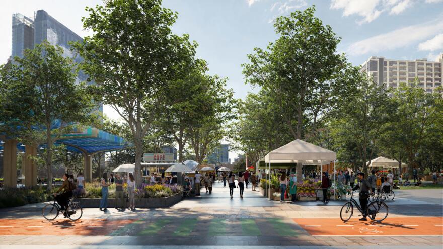
The forecast didn’t account for all the economic domino effects of covering a highway canyon in downtown Austin with amenities like parks, splash pads, athletic fields, performance spaces and buildings up to two stories tall. And it didn’t factor in any quality of life improvements that could come from bridging the highway that’s divided Austin since 1962.
But the gloomy presentation set the stage for the city’s top budget officials to caution council that borrowing heavily for the caps could push Austin’s debt per capita to unprecedented levels, risking a credit downgrade that would raise borrowing costs across the board and squeeze funding for other critical needs.
The city council must decide by the end of the month whether it will fund any of the “roadway elements” that would allow caps to be constructed in the future. Those elements include thickened walls along parts of the highway to support the weight of the caps and a space beneath the main lanes to catch hazardous materials in the event of a spill.

Roadway elements for the full 26.6 acres would cost $284 million. All the city has for the caps now is a loan from a state-run bank for $41 million. A $105 million federal grant is still in limbo.
The next caps bill for Austin, due before 2032, would be for an estimated $613 million to pay for the decks and core infrastructure over the highway.
Tacking on the landscaping, amenities and buildings for all 26.6 acres would bring the total to an estimated $1.4 billion. That number doesn’t include annual maintenance costs approaching $50 million. If costs go up, the city foots the bill.
Given that outlook, city staff working on the caps project made a new suggestion to the council Tuesday. Instead of building 26.6 acres of caps downtown and near the Hancock Center as originally planned, Austin could construct fewer than eight acres, covering just Cesar Chavez to Fourth Street and 11th to 12th Street. This sharply pared-down plan would reduce the total price tag to $360 million.

The political math is tight. Six votes are needed on the city council — made up of 10 members and the mayor — to advance or kill the project. The council is split between those who view caps as a once-in-a-lifetime moral imperative to reshape Austin for generations and those worried how the city’s growing debt load will weigh on demands for important needs.
“Working people in Austin are struggling. People don’t have enough food in parts of town. They don’t have affordable housing or reliable transportation. And I think as a council, we need to consider the whole city’s needs, not just downtown,” Council Member Mike Siegel said. “If we want to address inequity in parks and pools and libraries and senior centers around the city, we need to prioritize those projects.”
For other council members and Austin residents, though, the caps present a rare chance to reconnect neighborhoods long divided by the freeway and invest in the city’s future.
“For me, this is about healing a scar that I’ve lived through, that ripped through our city almost 100 years ago by way of the 1928 Master Plan,” said Council Member José Velásquez, referring to the city plan that created a racial segregation line along East Avenue, which later became I-35. “This is about making right a division that should never have existed.”
The council’s final vote on which roadway elements to fund — determining where caps could ultimately be installed — is set for May 22.
This story was produced as part of the Austin Monitor’s reporting partnership with KUT.