Council advances controversial rezoning, annexation deal
Monday, October 7, 2019 by
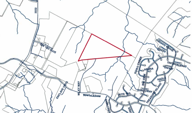
Ryan Thornton A cul-de-sac property at the western edge of the city’s limited purpose jurisdiction continues to fuel debate over appropriate levels of sprawl in Austin’s Hill Country.
Sitting at the end of Milky Way Drive, which is the site’s only access road, the 42-acre property rests atop a plateau in the city’s wildland-urban interface, the meeting point between development and vegetated open space where the risk of wildfire is a critical concern.
The property owner, MileStone Community Builders, has offered the city a trade: if City Council grants a rezone from Development Reserve (DR) to Townhouse and Condominium Residence-Conditional Overlay (SF-6-CO) zoning, allowing development of up to 45 homes on lots under 10,000 square feet, the city can annex the property and add it to the tax roll.
Council approved that request on second reading Thursday, despite strong objections from nearby residents.
City staff and neighbors agree that, considering the site’s limited access and wildfire risk, the requested densities are much too high.
Currently, only 25 homes are located along the road. Milky Way Drive resident Brian Showers said the neighborhood is comfortable with a maximum of 35 new homes on the property, but requested they be spaced apart on lots of at least 30,000 square feet.
It doesn’t make sense to build at above-average densities at the end of a cul-de-sac, with only one way out, Showers explained. For comparison, he said, the average lot size at the Preserve, a nearby subdivision, is 56,000 square feet.
Citing environmental sensitivity and the site’s relatively remote location, staff recommended granting Single-Family Residence – Large Lot (SF-1) zoning with a conditional overlay to limit unit count to 45 homes spaced on lots no smaller than 21,000 square feet.
The applicant has accepted the cap at 45 homes, but continues to push for the higher densities allowed by SF-6 zoning.
“My client prefers the SF-6 because my client likes to build homes that are closer to the median price. And 20,000-square-foot lots – that’s not the type of product that we would be able to deliver; there’d be million-dollar homes next to multimillion-dollar homes,” said Jeff Howard, representing MileStone.
Without the conditional overlay, SF-1 zoning sets minimum lot size at 10,000 square feet, in sharp contrast to the SF-6 minimum of 3,600 square feet.
Council Member Alison Alter worried that granting SF-6 could provide a loophole around the need to provide a secondary access point.
As a general rule, zonings from SF-1 to SF-3 are required to provide at least two access points for the convenience of city services. But under SF-6, which sometimes translates to townhomes or condominiums, that’s not always necessary.
In such cases, Fire Marshal Tom Vocke told Council in August, the requirement depends on the risk of wildfire. Here, he said, a secondary access would definitely be required if the zoning is granted for more than 30 homes. Debate continues over whether the road would be open to the public or for emergency use only.
Howard said the applicant intends to provide a secondary access road and that, given the limited access in the surrounding neighborhoods, it could also serve existing residents.
Giving weight to that commitment, Alter moved to amend the site’s conditional overlay to trigger the same connectivity process required under the SF-1 subdivision and site plan review.
Council approved the request on second reading 9-1, with Council Member Leslie Pool voting no and Council Member Natasha Harper-Madison off the dais. Council will take up the item for third reading, along with the proposal for annexation, on Oct. 31.
“I continue to be very uncomfortable with this case,” Pool said. “I think that’s way too much density to allow in this particular location.” The development, she said, would sit atop a plateau, in the exact spot “where fire would be racing up” in the case of a wildfire.
“It is not recommended by staff and the alternative resolution solutions that are being offered do not go, in fact, to the point about access that would preserve life safety for folks who may choose to live up Milky Way,” Pool said.
Randall Jamieson, Firewise director for River Place Homeowners Association, said he agrees “wholeheartedly” with Pool’s assessment about the location. “It’s not just near, it is the (wildland-urban interface),” he said. By his calculation, the location could have flames as high as 30 feet in the event of a wildfire.
However, Gilead Ziemba, a fire protection engineer with Fire Protection Consulting Group, said Jamieson’s modeling seems out of proportion to the actual conditions. Rather, he said, this development could actually be safer than adjacent neighborhoods due to its voluntary application of the international wildland-urban interface code.
“The Firewise program that was mentioned earlier is really more of a community initiative,” Ziemba said. “It doesn’t really provide a lot of the same criteria that the (international wildland-urban interface code) will provide.”
Map courtesy of the city of Austin.
The Austin Monitor’s work is made possible by donations from the community. Though our reporting covers donors from time to time, we are careful to keep business and editorial efforts separate while maintaining transparency. A complete list of donors is available here, and our code of ethics is explained here.
You're a community leader
And we’re honored you look to us for serious, in-depth news. You know a strong community needs local and dedicated watchdog reporting. We’re here for you and that won’t change. Now will you take the powerful next step and support our nonprofit news organization?