Environmental Commission recommends Council include Atlas 14 update in code rewrite
Tuesday, September 10, 2019 by
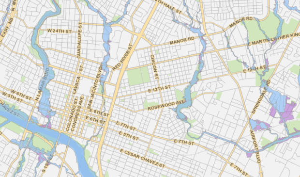
Jessi Devenyns Atlas 14 is a historical rainfall study that alters the city’s flood plains drastically, showing that Austin is projected to receive a 30 percent increase in rainfall. Nevertheless, the study is not something that can change development on its own.
To ensure that the updated Atlas 14 maps are considered during any development and redevelopment of Austin properties, Kevin Shunk, a flood plain administrator with the Watershed Protection Department, came to the Sept. 4 meeting of the Environmental Commission to request a recommendation to update the Title 25 and Title 30 sections of the city code related to flood plain regulations.
“We’re going to have more buildings that could be impacted by the 100-year flood,” explained Shunk – 7,200 to be exact.
In order to prevent increased development in vulnerable areas, part of the code amendment would include a revision of flood plain definitions. However, since new maps cannot be whipped up overnight to provide a nuanced view of the city’s flood risk, Shunk said that Watershed Protection is proposing using an interim definition for three years. This short-term solution would simply redefine the current 500-year flood plain as the 100-year flood plain. Likewise, the 100-year flood plain would be redefined as the new 25-year flood plain.
“It sounds to me like we’re taking the worst-case scenario and extrapolating it to the entire city of Austin,” said Commissioner Andrew Creel. He said he was concerned that in certain areas, redevelopment is “going to end up being untouchable in the next two to three years, which will only exacerbate our current affordability crisis.”
Creel abstained from the vote to recommend these changes, which passed 8-0-1.
Several members of the community came out to speak to the commissioners to express their worry that such a change would jeopardize their ability to do home improvements. Eighty percent of the buildings in the new 100-year flood plain are residential.
Under the proposed revisions to the Land Development Code, there is a redevelopment exception in which a building permit will be administratively approved if a homeowner can prove she is not adding additional units to an existing building, is at least two feet above the flood plain and is not having an adverse impact on flood risk.
Shunk said redevelopment is defined as “moving dirt or modifying or building.”
Putting the onus on homeowners to redevelop with flood risk in mind will help the city speed up the process of reducing the risk citywide. With the updated flood plain maps, 3,200 new buildings will be in the flood plain, and as the rate that the city can mitigate risk is 53 homes per year, it will take 135 years to address each new building.
Overall, 3 percent of buildings in the entire city will be in the new 100-year flood plain.
Protecting these structures was also a hot topic at the commission meeting. Along with changes to the maps themselves, there will be corresponding changes to flood insurance premiums. As a result, “it’s very advantageous to buy (flood insurance) before it changes,” said Shunk. He told commissioners it will take up to three years for the city to submit new maps to FEMA, at which point it will take some time before the updates affect insurance rates.
Although seemingly far in the future, Commissioner Pam Thompson noted it is important to inform the public now to give the best chance of locking in cheaper rates. The Watershed Protection Department has been working diligently to inform affected homeowners, according to Shunk.
While these updates to code are working their way through the city’s boards and commissions on the way to Council on Oct. 17, the Watershed Protection Department is working on revising the Drainage Criteria Manual. The draft for the updates was released in August and will be receiving comments and evaluation until January.
Staff explained it was at the public’s suggestion that the work has so many irons in the fire in order to keep this update process as simultaneous as possible. Yet there is still a lot of work to be done.
Commissioner Wendy Gordon was absent.
Map courtesy of ATX Flood Pro.
The Austin Monitor’s work is made possible by donations from the community. Though our reporting covers donors from time to time, we are careful to keep business and editorial efforts separate while maintaining transparency. A complete list of donors is available here, and our code of ethics is explained here.
You're a community leader
And we’re honored you look to us for serious, in-depth news. You know a strong community needs local and dedicated watchdog reporting. We’re here for you and that won’t change. Now will you take the powerful next step and support our nonprofit news organization?


