CodeNEXT, as explained to a 6-year-old
Tuesday, April 18, 2017 by
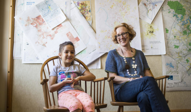
Audrey McGlinchy, KUT Two people – one grown, the other growing – sit in a University of Texas office. The younger one, a girl of just 6 years old, wears a gray T-shirt, pink leggings and cowboy boots, which dangle from the edge of her chair. The other, a woman, wears a blue linen top and bangles on her arm. Between them sits a document of more than 1,000 pages.
“What do you think of when you hear the word code?” Elizabeth Mueller, associate professor of community and regional planning, asked Violet, the daughter of KUT’s Jimmy Maas.
“It’s like a password,” Violet answered.
Well, sort of.
“It’s kind of like the rules or the secrets for how to do something,” Mueller said. “So a city code is the rules for what we’re allowed to build in different parts of the city.”
Mueller tried to explain the process of CodeNEXT to the first-grader. The city’s rewrite of its land-development code is intended to simplify the code and focus on the character of the neighborhood rather than a building’s use – its “form” rather than its “function.” Under the current code, each individual plot of land has a designated use.
As explained to a 6-year-old, the code has the power to dictate a lot: “Do you want three floors in your house? Do you want space in your driveway for more cars?”
In January, the city released the draft text of the new code. Since then, various interest groups across the city have been meeting to better understand the code and how to advocate for the changes they want. This morning, the city is set to release maps that will show where each form of the new code will apply.
Here’s how Mueller broke that down:
“So right now we have this big book and it has all the rules in it,” she said. “But then when we get these maps, they’re going to give us more specific information. So they’ll say, ‘The rules for you because you live in this certain place are …’ but if you live somewhere else, you get different rules.”
The various zones dictate building restrictions across lower-density areas, like central neighborhoods, up to the city’s urban core, such as downtown. The less dense parts of the city will most likely remain under the current, use-based code. The city’s more central areas will likely be governed by transect zones, which are intended to promote density.
The city’s more central areas will likely be governed by transect zones, which are intended to promote density. The various zones dictate building restrictions across lower-density areas, like central neighborhoods, up to the city’s urban core. The less dense parts of the city will most likely remain under the current use-based code. Alina Carnahan, CodeNEXT public information specialist, told the Monitor that the city will lay out those additional zones with the draft map that comes out today.
“We actually looked at some places and you’re right, they (don’t) all necessarily … capture the existing zones we have, capture the character of those places, so we made even more,” said Carnahan.
Photo by Martin do Nascimento/KUT. This story was produced as part of the Austin Monitor’s reporting partnership with KUT.
The Austin Monitor’s work is made possible by donations from the community. Though our reporting covers donors from time to time, we are careful to keep business and editorial efforts separate while maintaining transparency. A complete list of donors is available here, and our code of ethics is explained here.
You're a community leader
And we’re honored you look to us for serious, in-depth news. You know a strong community needs local and dedicated watchdog reporting. We’re here for you and that won’t change. Now will you take the powerful next step and support our nonprofit news organization?


